hinesb
-
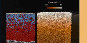
Granular Matter webinar series
Professor Antoinette Tordesillas delivered a webinar for the Granular Matter Journal. See the webinar belowsafe-risccs.science.unimelb.edu.au/2022/07/06/granular-matter-webinar-series
-
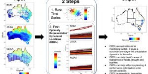
Discovering optimally representative dynamical locations (ORDL) in big multivariate spatiotemporal data: a case study of precipitation in Australia from space to ground sensors
New paper led by Ben Hines points to dynamics and locations of extreme on precipitation events in the Australian continent, using data from BoM’s rain gauge network and multiplatform JAXA-NOAA remote sensing. Read article here. -
Forecasting landslides from space
A new data-driven tool uses satellites to accurately predict devastating natural disasters before they occur – locating potential land failures to protect at-risk communities. Read the story on Pursuit.safe-risccs.science.unimelb.edu.au/2022/06/09/forecasting-landslides-from-space
-
Discovering optimally representative dynamical locations (ORDL) in big multivariate spatiotemporal data: a case study of precipitation in Australia from space to ground sensors
We would like to draw attention to the work of one of our researchers Benjamin Hines, who has a newly published paper “Discovering optimally representative dynamical locations (ORDL) in big multivariate spatiotemporal data: a case study of precipitation in Australia from space to ground sensors.” His work conducts a kind of ‘data fusion’ from rainfall […] -
Methodology to deal with extremely high dimensional, nonstationary, land topography data
We congratulate one of our researchers, Hangfei Zheng, for her recent work in developing methodology to deal with extremely high dimensional, nonstationary, land topography data. This is a key advancement in dealing with “big data” issues that arise in our work in predicting large scale catastrophic failure events such as landslides. These, by their nature, […] -
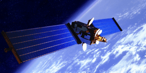
Sentinel 1 Mission
Two of our researchers, Ran Huo and Michael Manthey have been involved in processing complex satellite data from the European Space Agency’s Sentinel 1 mission. This uses a microwave technique known as “synthetic aperture radar” to record soundings of the entire globe. These are relatively impervious to weather conditions unlike optical imaging and once “unwrapped” […]safe-risccs.science.unimelb.edu.au/2022/05/31/sentinel-1-mission


